|
City for 10'000 Residents.
Facts: Commission by the Qargha Lake Settlement GmbH, Zug | City for 10 000 Residents along the Qargha-Lake, Kabul, Afghanistan | Master Plan and
Type-Houses | Design 2004 | Area: 150 ha.
Architects: Ivica Brnic, Florian Graf, Wolfgang Rossbauer (Brnic
| Graf | Rossbauer Architects, Zürich).
After
thirty years of war and the „liberation“ by US forces
Afghanistan is in a phase of rapid reconstruction. Especially
in the cities along the central Asian road (Kabul, Herat, Masar-i-Sharif)
countless uncontrolled residential and commercial areas are sprouting
out of the earth. „Finished“ urban design, as can
be implemented by totalitarian government, needs an entirely new
approach: Changing power constellations, as well as market economy
mechanisms, redefine the urban development and the form of construction
on a daily basis.
Approximately
twenty kilometers west of Kabul a town with complete infrastructure
is to be created for diplomats and the rising afghan middle class.
Many of the returning expatriates, who have settled in foreign
countries during the countless wars, now return to build businesses.
 Kabul in the
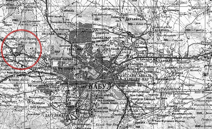
middle, Qargha around 20 kilometers to the west. Kabul in the
middle, Qargha around 20 kilometers to the west.
The
250 hectare area, with a largely southern inclination around the
„Qargha“ lake, is served by a regional road. A circular
system of roads around the lake ensure the fastest access to the
regional road for all parts of the city and can be expanded simply
by adding additional road following the contour lines of the landscape
up the hill. All sections of the city are divided into subdivisions,
which are also organized along the contour lines. The subdivisions
are accessible from two sides and can be divided into building
lots of 500 to 2000 square meters, in special cases a merger of
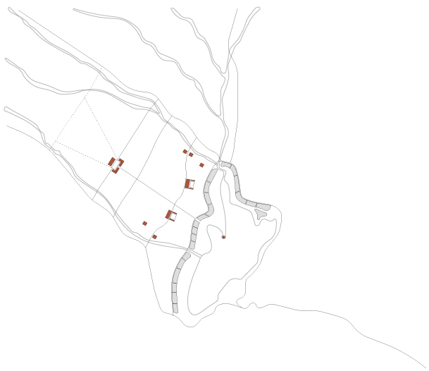
up to 20 000 square meters. On some prominent points in the topography
in the center of the city large squares are planned which are
to be flanked by representative public buildings. These offer
a quiet public terrace with views on the lake. An axial street
pierces the city center. This gives the city structure and connects
the administrative buildings and northwestern neighborhoods with
the lake. At the beginning this avenue will be lined on both sides
by trees, these will successively be replaced by buildings: Commercial
buildings line a broad shopping street which meets the lake promenade.
The mosque, being the point of orientation for the whole city,
is placed in the middle of the lake and in line with the axial
street.
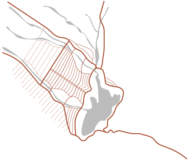
Main and side
streets.
Public buildings
around the lake and at prominent locations in the city.
Parkways around
the lake and in the axial street.
The
lake is pronounced as the center of city by the surrounding promenade,
which is lined on both sides by trees. This promenade is underlined
by hotels, restaurants and luxury apartments which are served
by a secondary road running behind them so that they can be in
direct contact with the pro-menade. Large parks surround the mouths
of the rivers feeding the lake in spring. The banks of these streams
already offer a rich natural habitat and will add great quality
to the city as natural reserves. It will serve the neighboring
building as natural leisure park.
The
concepts determining this city can be summed up as a combination
of „tracing nature“ and „artificial elements“.
On the one hand the planning attempts to read natural realities,
such as of orientation, topography, and bodies of water, in order
to integrate them in the basic structure that generates the city.
The pronunciation of these elements gives the city an identity,
which can be generated with minimal means and endure changing
premises. On the other hand there are memorable formal artistic
implants. The strongest example of this is the main axis street
between the administrative buildings and the mosque. This gives
the heart of the city a metropolitan dimension. This kind of formal
artistic intervention requires a political will and effort to
be implemented.
The
combination of these approaches is sustainable in two ways: Through
the strong integration of the „present realities“
of the planning it has high chances of being implemented. It follows
a natural logic of which the spatial impression can assert itself
in future phases. Also the efficient access and versatile plots
allow a reaction to eventual unforeseeable events.
|